Lowest Safe Altitude (LSALT)
Grid LSALTs
Grid LSALTs are calculated for an area of 1 degree of latitude x 1 degree of longitude, and can be used by any aircraft inside that grid.
Route LSALTs
Route LSALTs are valid for RNP2-approved aircraft tracking via an airway, as shown on the relevant chart.
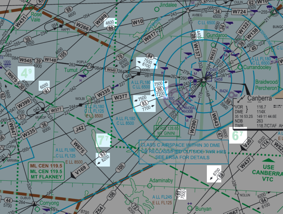
Charts
Grid LSALTs and Route LSALTs can be found on TAC and ERC Low charts, as shown below
Rules
It is the responsibility of the pilots to plan their flight above LSALT if they are IFR. However, ATC cannot clear an aircraft below LSALT, and any aircraft receiving a FIS that has planned below LSALT, shall be queried to ensure the pilot is aware.
An IFR aircraft is permitted below LSALT when:
- They have reported Visual
- They are using a "Pilot-Calculated" LSALT
- They are in the course of a normal departure/approach procedure
Info
Pilots can calculate their own LSALT from numerous different sources, such as aerodrome 25nm and 10nm MSAs, VOR/NDB/DR tracking tolerance splays, and others. Bottom line is, if a pilot says they are using a Pilot-Calculated LSALT, they have taken full responsibility for their own separation with terrain.
Radar Terrain Clearance Chart (RTCC)
On VatSys within some TCUs, the RTCC map can be displayed to show local, more precise terrain clearance levels within TMAs, shown below at Perth
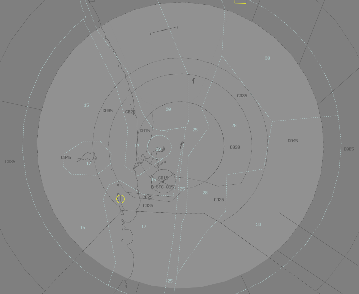
Aircraft can be cleared within CTA down to the level shown on the RTCC, and this can be used to supplement any local Grid LSALTs, Route LSALTs, and MSAs.
Visual
Once an aircraft has reported visual, LSALTs are no longer a factor. However, if clearing an aircraft to an altitude that is below Grid LSALT, Route LSALT, or MSA, the controller must append the word "Visual" to the clearance. This also applies to any assigned headings, or route clearances, when the aircraft is cleared to a level below LSALT.
Phraseology
MAE: "AM328, Report in-flight conditions"
AM328: "AM328, visual"
MAE: "AM328, Descend to A040 visual"
AM328: "Descend to A040 visual, AM328"
Examples
Phraseology
ABC: "Melbourne Centre, PA44, ABC, POB 2, IFR, Taxiing YSWG for YMCO, Runway 23"
BLA: "ABC, Melbourne Centre, Squawk 3601, No reported IFR Traffic"
ABC: "3601, ABC"
BLA: "ABC, you've planned below Grid Lowest Safe, advise intentions"
ABC: "Roger, ABC, request amended A090"
BLA: "ABC, no additional reported IFR traffic, expect that"
ABC: "ABC"
Phraseology
DEF: "Brisbane Centre, PC12, DEF, POB 6, IFR, Taxiing YBUD for YROM, Runway 32"
KPL: "DEF, Brisbane Centre, Squawk 3601, No reported IFR Traffic"
DEF: "3601, DEF"
KPL: "DEF, you've planned below Grid Lowest Safe, advise intentions"
DEF: "We've calculated our own lowest safe, DEF"
KPL: "DEF"
KPL will enter "PCALC" in label data.